Managing Agency: BLM
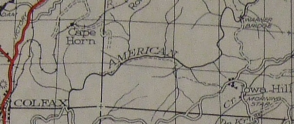
This 1944 Tahoe National Forest map shows the trail from Iowa Hill crossing the river but not continuing all the way to Colfax. Also interesting to note is that the Blue Wing Trail is incorrectly shown as a road to Warner Bridge.
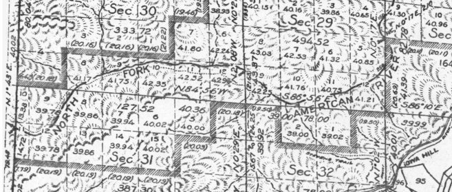
An explanation for the 1944 TNF map not showing the trail going all the way to Colfax might be found in the 1928 General Land Office map for the township (T15NR10E). This map shows the same exact portion of the trail and shows the trail to just beyond the limits of its boundary, the township. Colfax and the western portion of the trail are in a different township and the map for that township was created in 1865 before the trail was constructed.